


Originally, I was going to let others write about Hormuz. And then I came across this tweet that stirred a viral debate:
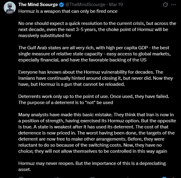
Hormuz has always been a chokepoint, going back thousands of years. Using it as a weapon for trade and military has been used MORE than once, as we’ll soon see.
The answer is in short:
Geography is destiny.
Chokepoints like the Strait of Hormuz alter the balance of power and economics in a region. They determine the rise and fall of empires, century after century.
To understand why, you need to understand the strait itself….
The bottom of this article could be cut off in some email clients. Read the full article, unbroken here.
Geography makes the strait a natural tollbooth
Look at the strait from above, and you see the problem
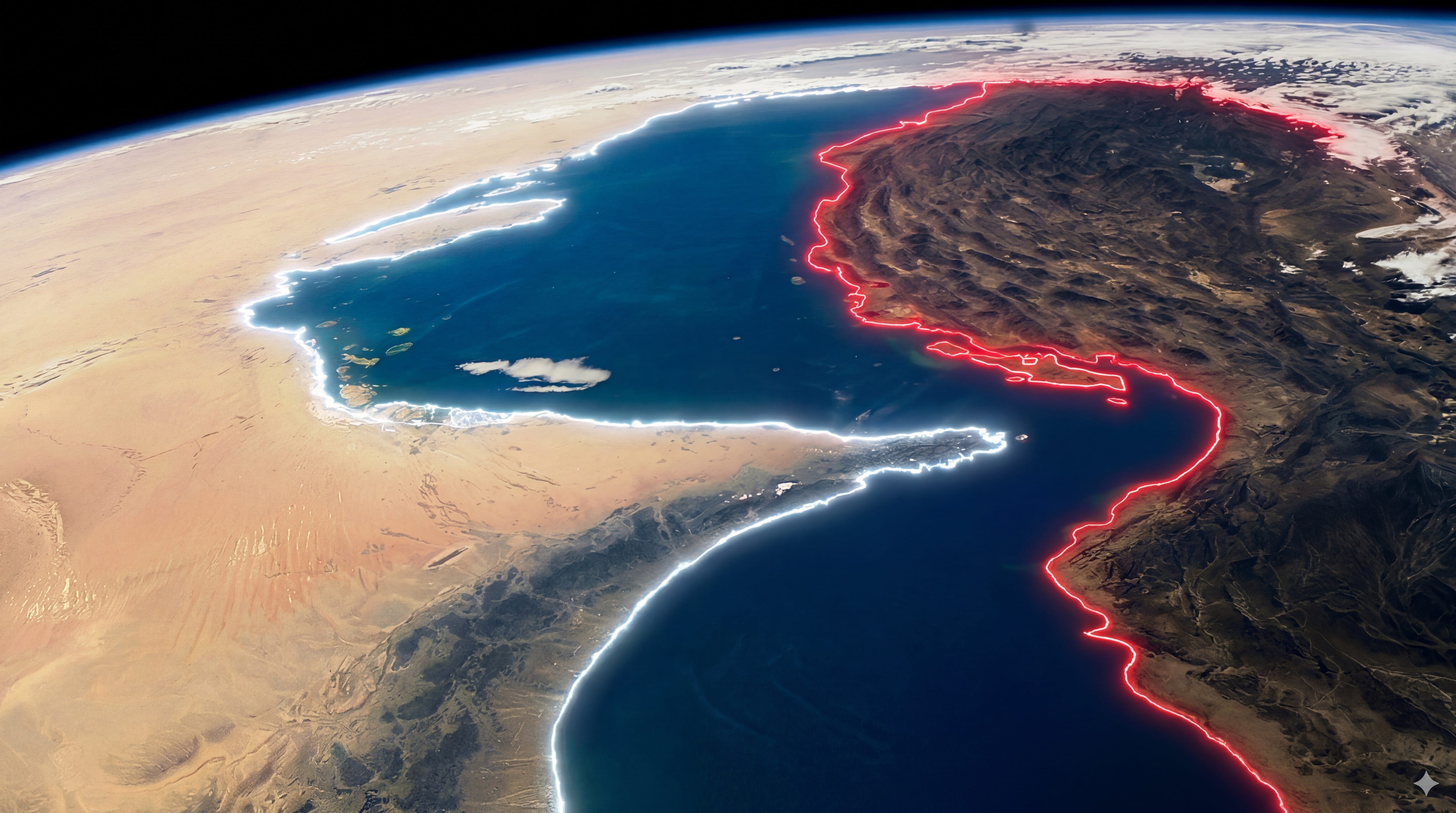
The Strait of Hormuz connects the Persian Gulf to the Gulf of Oman and the Arabian Sea. Iran’s coast forms the north shore. Oman’s Musandam Peninsula and the UAE form the south shore. It follows a natural curve.
That’s right. It’s a natural toll booth:
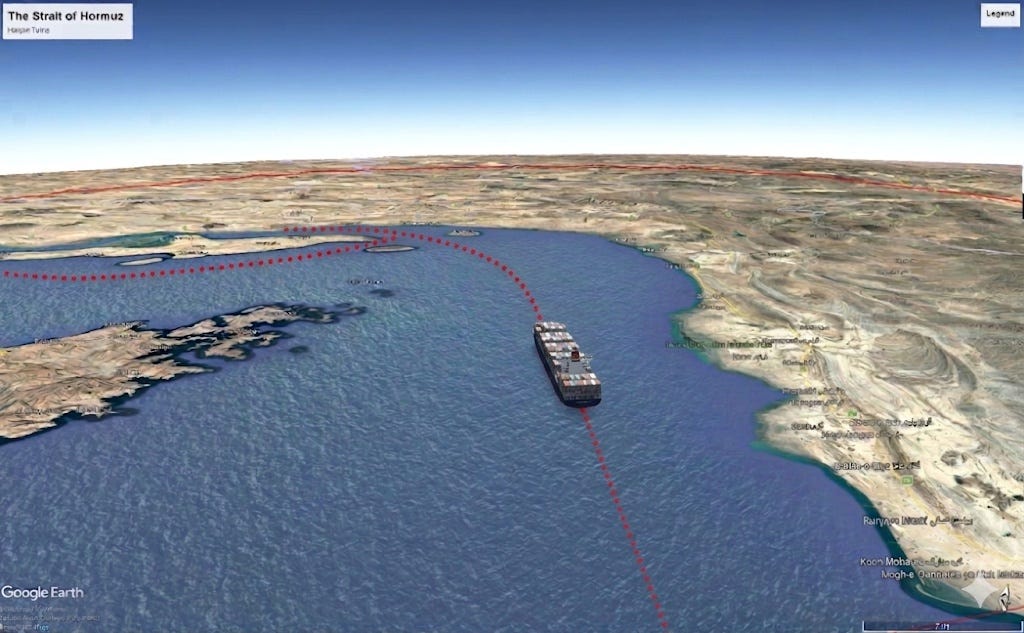
Six physical features stack the strait in favor of whoever controls it:
The hairpin. A tanker moving through a straight channel can maintain speed and maneuver around obstacles. A tanker rounding a hairpin turn must slow down, commit to a course, and pass through a fixed corridor between land masses on both sides, within visual and radar range.
The islands at the bend. Iran’s islands sit at the point where ships are slowest. Boats from Qeshm or Larak reach the shipping lanes in minutes. In the modern era, shore-based missiles, drones, and artillery cover the entire passage.
The overlapping sovereignty. Iran claimed 12 nautical miles of territorial water in 1959. Oman claimed 12nm in 1972. The strait The claims overlap in the center. No ship transits without entering at least one country’s waters.
The tiny corridor. Six miles of usable shipping lane out of 21 miles of total width. The Strauss Center described the lanes as offering “very little room for maneuver.” A supertanker drawing 20-25m cannot deviate without running aground on the shallow margins. An ideal area for naval mines.
No detour. Iraq, Kuwait, and Qatar have zero pipeline alternatives. Saudi Arabia and the UAE have pipelines, but combined spare capacity: ~2.6 million bpd. The strait carries 20 million. About 84% of crude goes to Asia. China, India, Japan, and South Korea receive 69% of the total flow.
At its narrowest at 21 miles. The shipping lanes occupy a fraction of that width.
Two lanes, each two miles wide, with a two-mile buffer between them. Deep-draft tankers must stay in these corridors because the surrounding waters are too shallow:
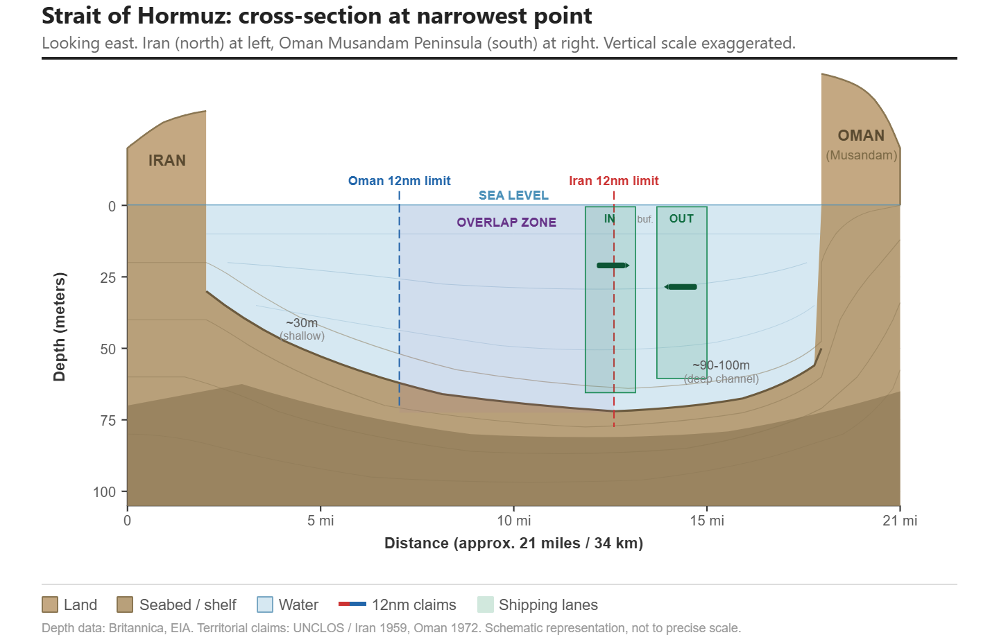
In 1959, Iran expanded its territorial waters to 12 nautical miles from shore. Oman did the same in 1972. The combined territorial claims cover the entire strait. No ship transits the passage without entering Iranian or Omani waters, or both.
Even US Navy supercarriers must transit the strait in these set sea lanes, as you can see in this old video:
But it’s the islands that count for control of the Strait.
The Islands
As tankers and ships pass through the Straits, they encounter several islands.
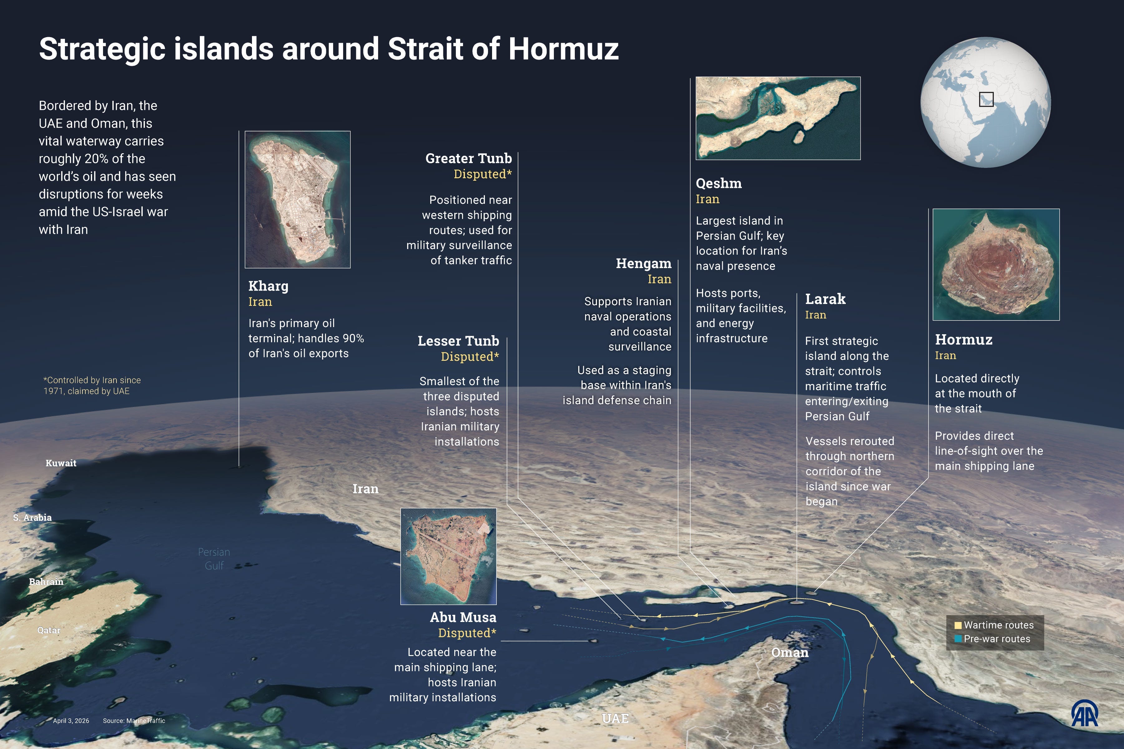
These are not uninhabited rocks. They are strategic positions that have been contested, occupied, and militarized for decades. Whoever controls these islands controls the geometry of the strait itself. They sit directly along the shipping lanes, close enough to monitor every vessel that passes and close enough to threaten them:
The Eastern Approach
Several islands sit at or near the mouth of the strait. Iran controls four of them:
Qeshm Island stretches 135 kilometers along the Iranian coast at the strait’s northern edge. It is the largest island in the Persian Gulf.
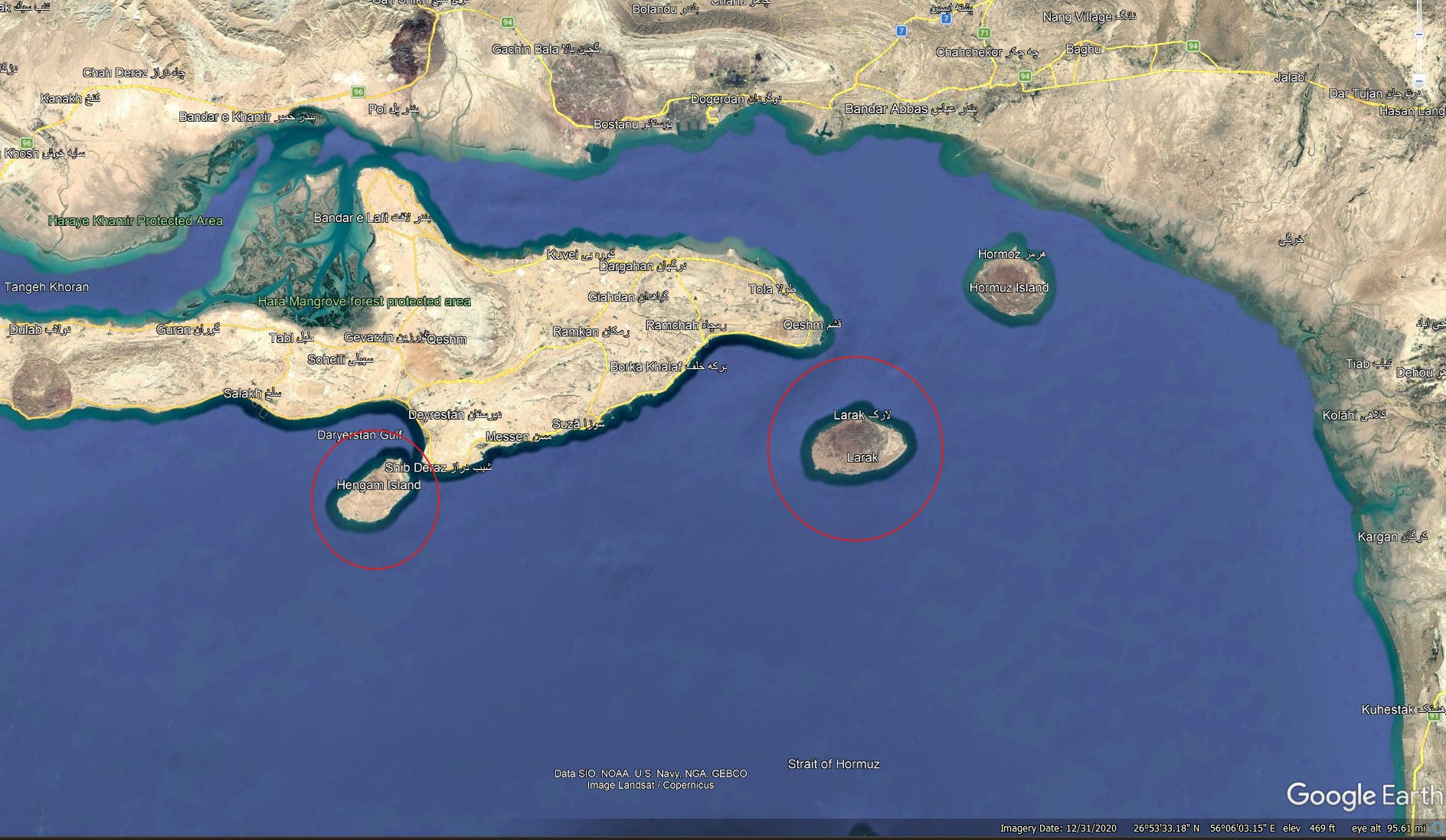
Larak Island sits 35 kilometers southeast of Qeshm, right in the middle of the passage. Between them: a narrow corridor of Iranian territorial water.
Hengam Island sits just 2 kilometers off the southern tip of Qeshm.
Hormuz Island is the gatekeeper to the entrance of the strait. Only 8 kilometers from the mainland and sitting near the major port of Bandar Abbas.
The IRGC built naval bases, radar installations, and missile batteries on all four of these islands. Lets go over these islands.
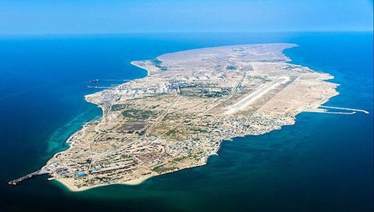
Qeshm is the largest island in the Persian Gulf, positioned right at the strait’s northern edge:
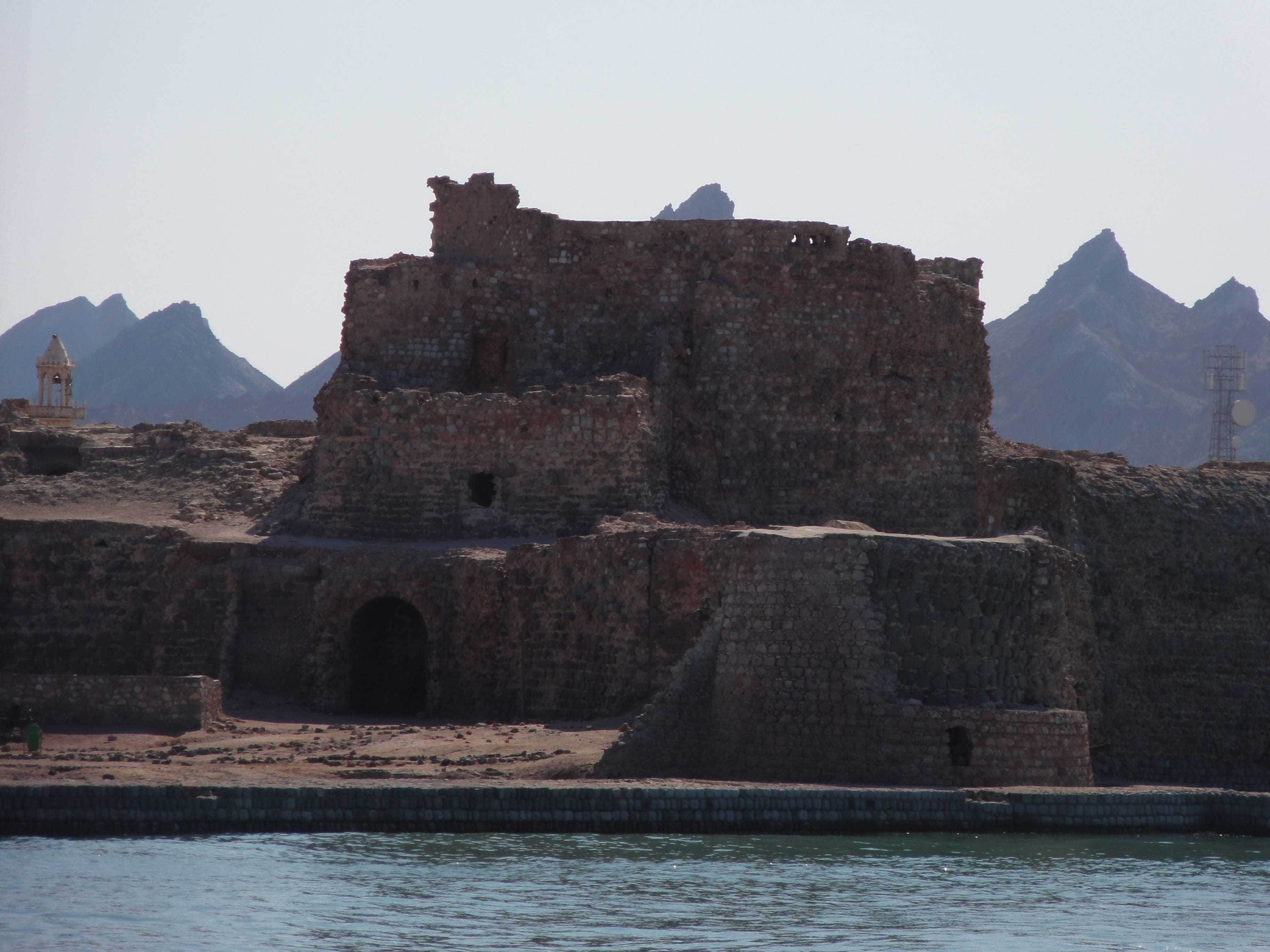
Hormuz Island, the old medieval trading post (we’ll talk about that next) sits northeast of it:
Larak and Hengam also sit in the passage:
All four are eyes overlooking the deep-water channel. From here, Iranian coastal surveillance can identify a ship’s name, flag, and cargo before it even reaches the narrowest point.
The Western Approach
But that’s not all. Iran has control over 4 other islands that sit across the shipping lane to the west of the strait:
Greater Tunb
Lesser Tunb
Abu Musa
Siri
Iran seized Greater Tunb, Lesser Tunb, and Abu Musa from the UAE in 1971, the day Britain’s treaties expired. The UAE still contests sovereignty, a point that’s important to the current Iran War.
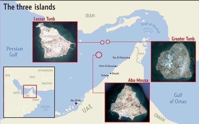
These islands give Iran something unique among the world’s chokepoint powers:
